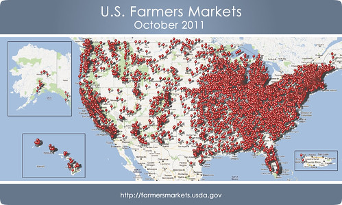
With nearly 2 million page views in 2011 alone, the USDA National Farmers Market Directory is one of the Department of Agriculture’s most popular consumer search engines. Over 7,200 farmers markets across the country have voluntarily listed themselves in the USDA Farmers Market Directory. The USDA Farmers Market Directory is searchable by zip code, product availability, payment method and even if the market participates in federal nutrition programs like the Supplemental Nutrition Assistance Program (SNAP, formerly known as food stamps), Women, Infant and Children (WIC) , WIC Cash Value Vouchers (WIC CVV) and Senior Farmers Market Nutrition Programs (SFMNP).
But wait, there’s more! As part of the USDA’s continued commitment to the principles of open government, and the remarkable response the USDA had when we released geocodes from the 2010 USDA Farmers Market Directory, an enhanced set of geocodes from the 2011 USDA National Farmers Market Directory is now available via data.gov. This Excel file shows street addresses and geocodes for over 6,200 markets in the US. That’s a 33 percent increase of geocodes available over last year.
We’ve built a new map based on the 2011 USDA Farmers Market Directory geocodes. What will you build?

